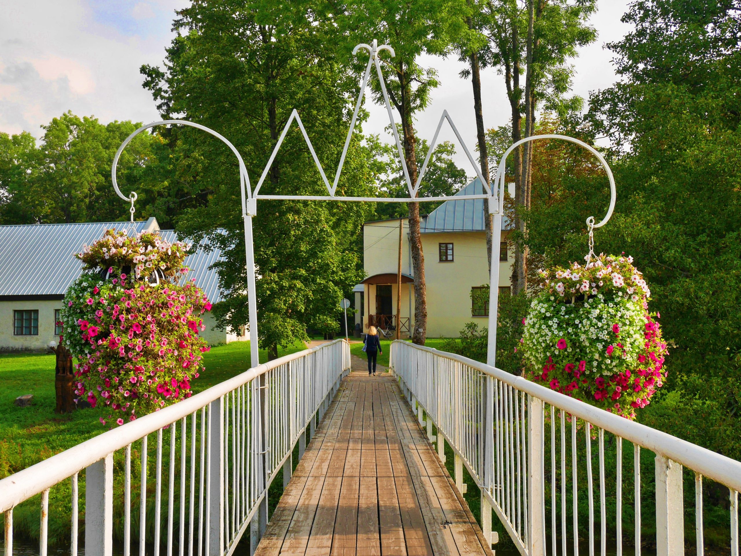
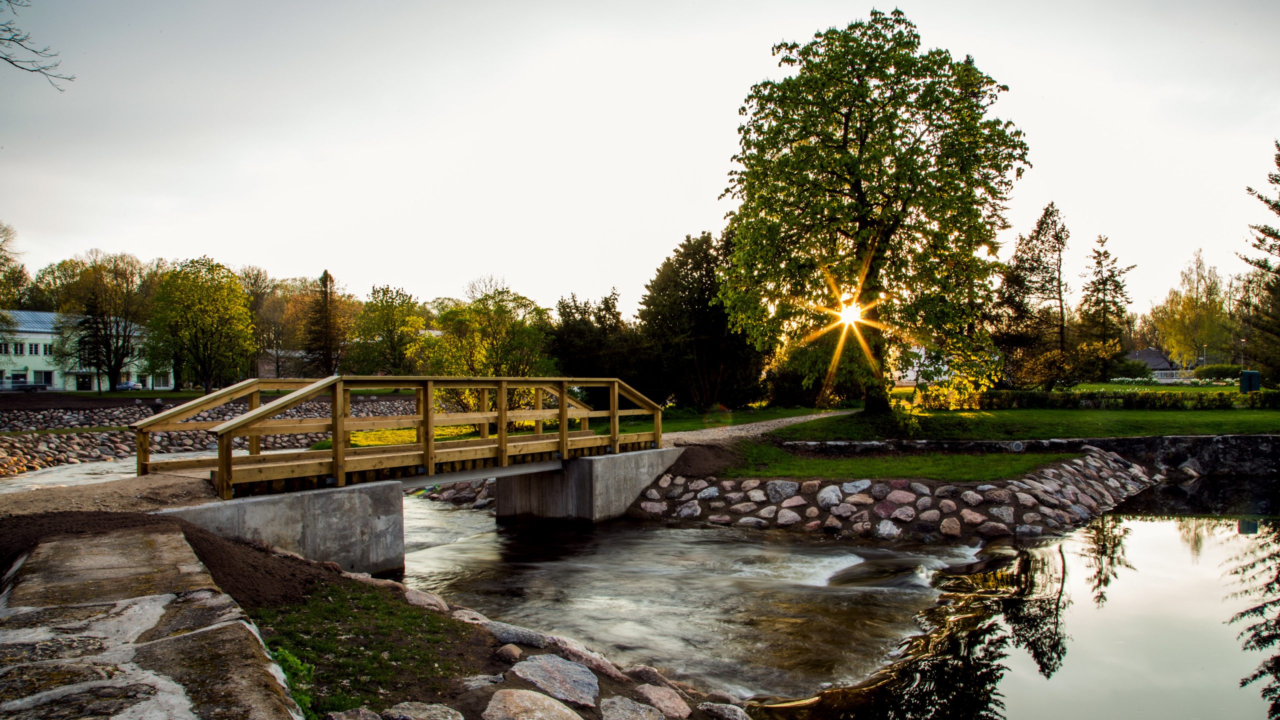
Small, but with a special soul, Põltsamaa is like a hidden gem in the middle of Estonia. The River Põltsamaa flowing through the town has formed five islets connected by numerous bridges. As a result, the town has received the proud title – the town of 19 bridges – and is often called the bridge capital of Estonia.
When you arrive in the town center you will come across the Big Bridge (Suur sild) – it is like the king of bridges, the only one you can drive directly across the River Põltsamaa. Ring Road Bridge (Ringtee sild) and Mill Bridge (Veski sild) also allow car traffic, but they cross the Mill Canal (Veskikanal) instead. The Small Bridge (Väike sild) also crosses the same canal, but you cannot drive here – this wide pedestrian bridge invites visitors to enjoy the fresh air. And of course, there are a whole bunch of other bridges in Põltsamaa that lead across the river, but are intended only for pedestrians: the Courthouse or Teacher’s Bridge (Kohtumaja ehk Õpetaja sild), the Sauna Bridge (Sauna sild) and the Parvei or Church Hill Bridge (Parvei ehk Kirikumäe sild). All the other bridges jump over a small stream and moat, connecting the islets to the riverbanks.
Take your time, enjoy and discover – the bridges of Põltsamaa are waiting for you on an exciting journey!
We recommend planning your time for the bridge tour as follows:
🚶♂️➡️ on foot – 1-1,5 hours; 🚴 by bicycle – 0,5 -1 hours; 🙋♀️ – with a guide around 2 hours.
We have prepared a self-guided bridge tour, with the full route shown on the map and the bridges listed below in the suggested order of visit.
1. CASTLE BRIDGE (LOSSI SILD)
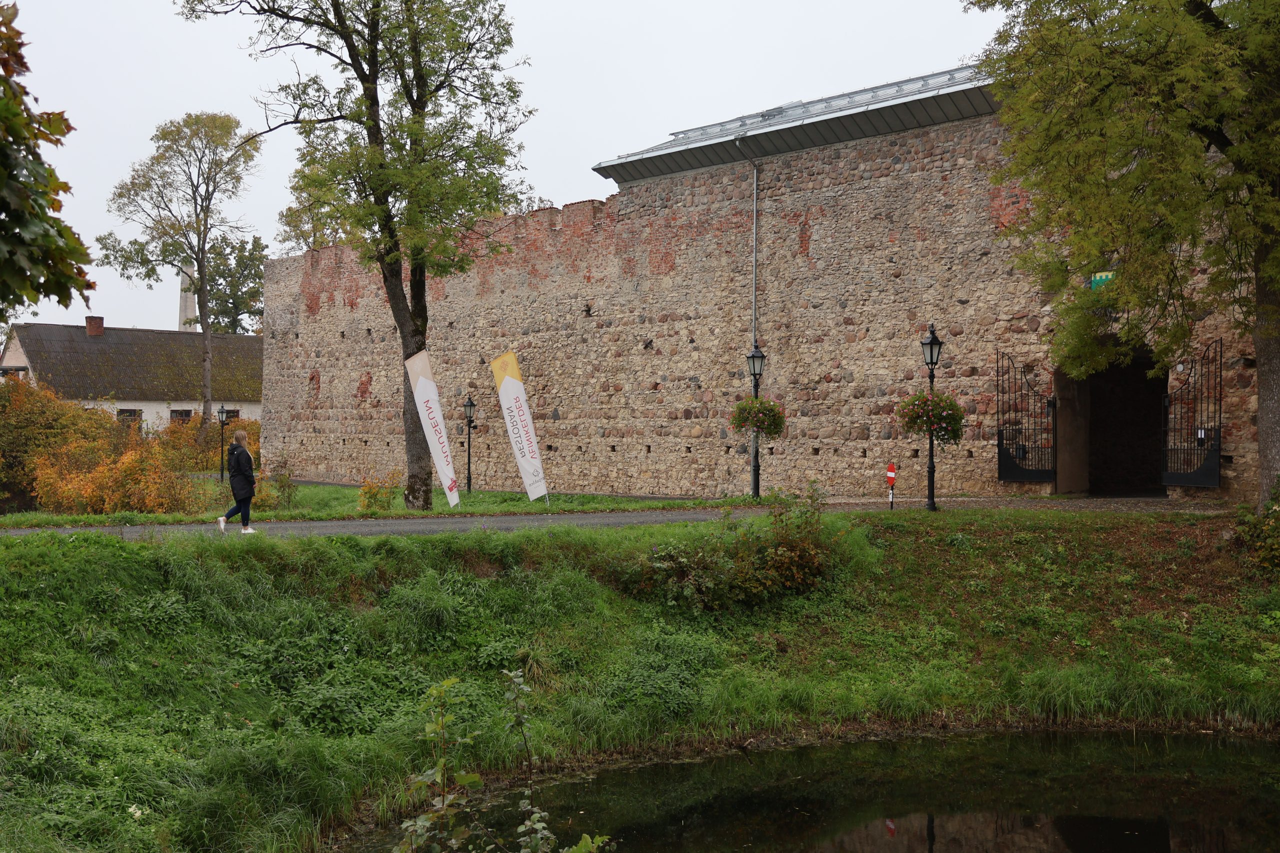
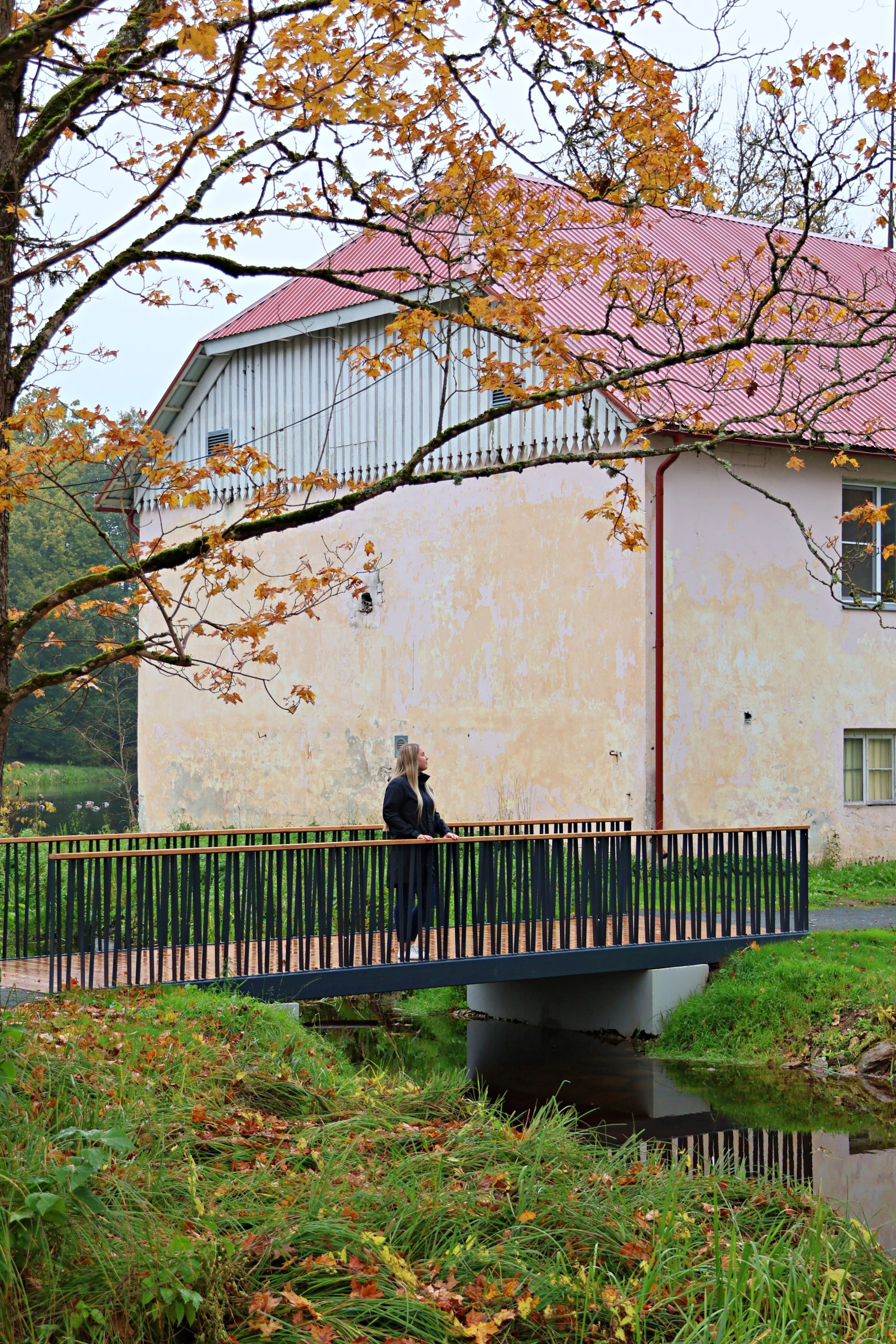
When you cross the moat from Tallinn Road to the Põltsamaa Castle, you step over the Castle Bridge (Lossi sild). It’s not just a bridge – it’s a shortcut to the castle built in 1272, where today you can learn about history, enjoy crafts, taste good wine, fill your stomach at the restaurant Oberpahlen, and do much more. In the 17th century, there was a diagonal drawbridge here.
2. CHURCH BRIDGE (KIRIKU SILD)
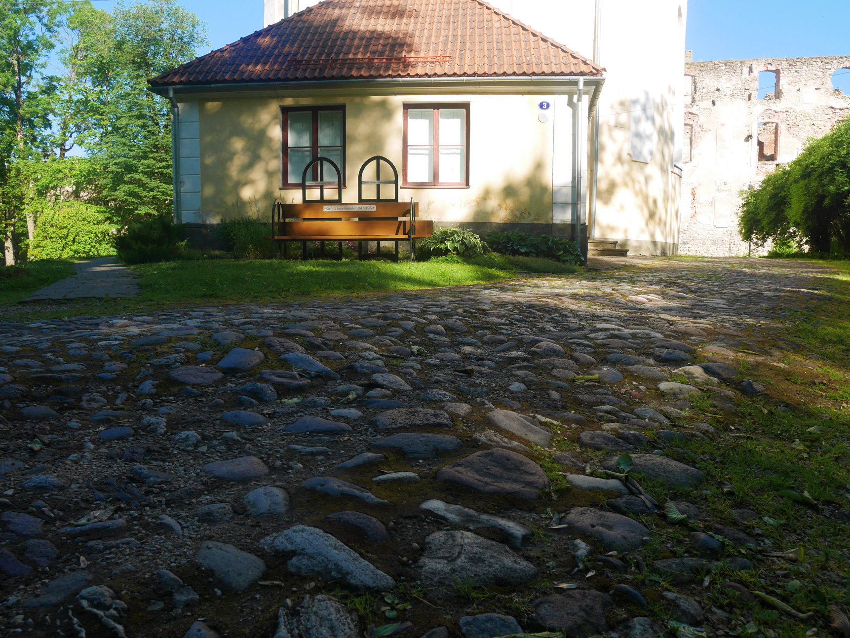
The large and magnificent Põltsamaa Niguliste Church, where the EELK Põltsamaa congregation operates today, is connected to Põltsamaa Castle. The small cobblestone bridge leading to it, which was already depicted on the 17th-century plan of the castle, is also named after the church.
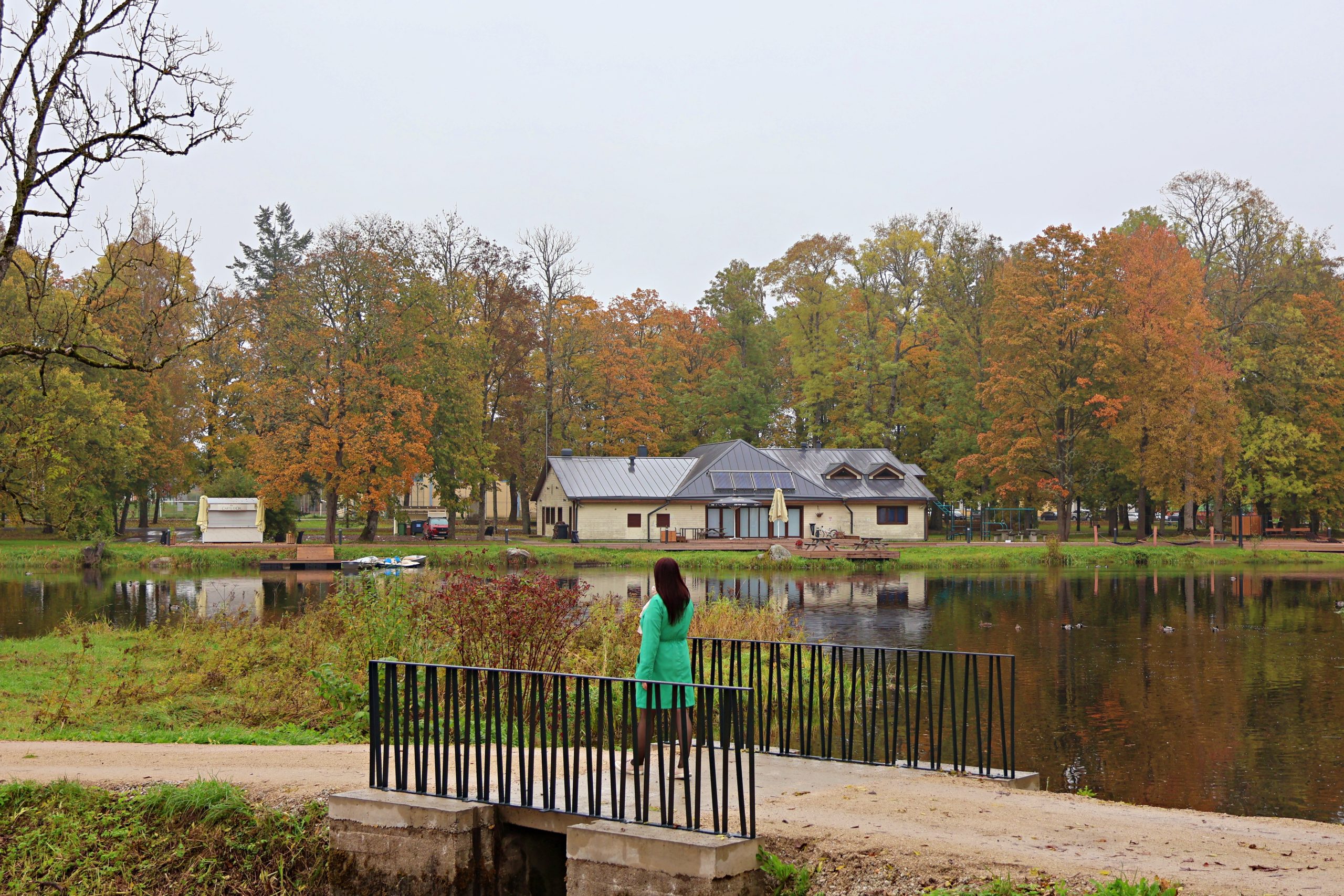
3. POND BRIDGE (TIIGI SILD)
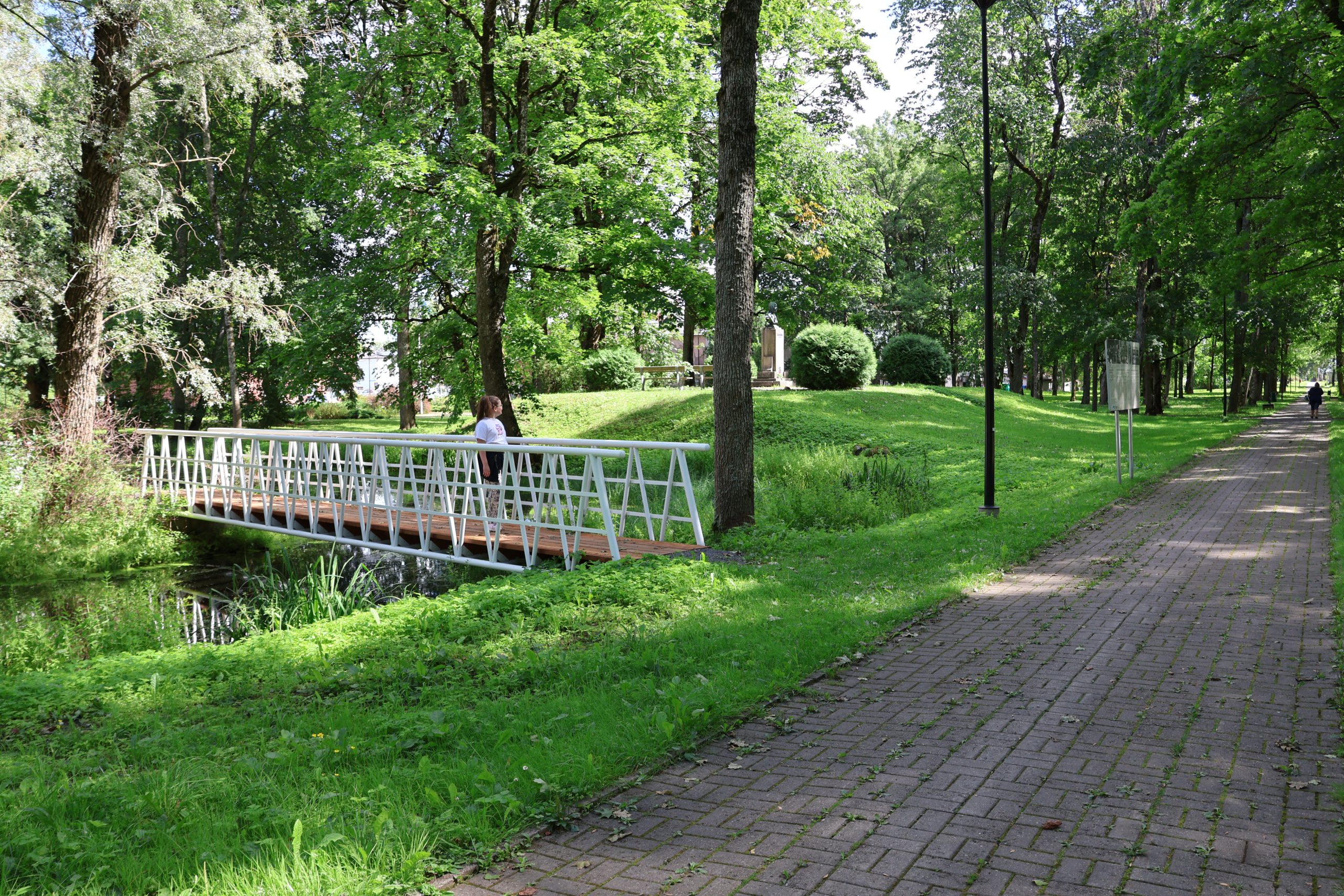
You’ve been to the castle, you’ve seen the church – now straight to the park! Before that, stop by the Asian restaurant Vaga Mama, which is located directly across the road from the church in the shade of the park trees. 5.5 hectares of free-form beauty and the feel of a forest park await you in the Old-Põltsamaa Manor Park. The park has one clearly defined main road, complemented by several smaller side paths. In the northern part there is a pond with a small islet and a Pond Bridge (Tiigi sild) leading across the water. In the park you will also meet the composer Karl August Hermann (1851-1909), in whose honor a memorial has been created, which stands right on a small hill near the pond.
In the same park there is the Emilie Beermann Flag Field, which is dedicated to Emilie Beermann, who sewed the first blue-black-and-white flag for the Estonian Students’ Association. Later, it became the Estonian national flag, and therefore Põltsamaa is considered as the birthplace of the Estonian flag.
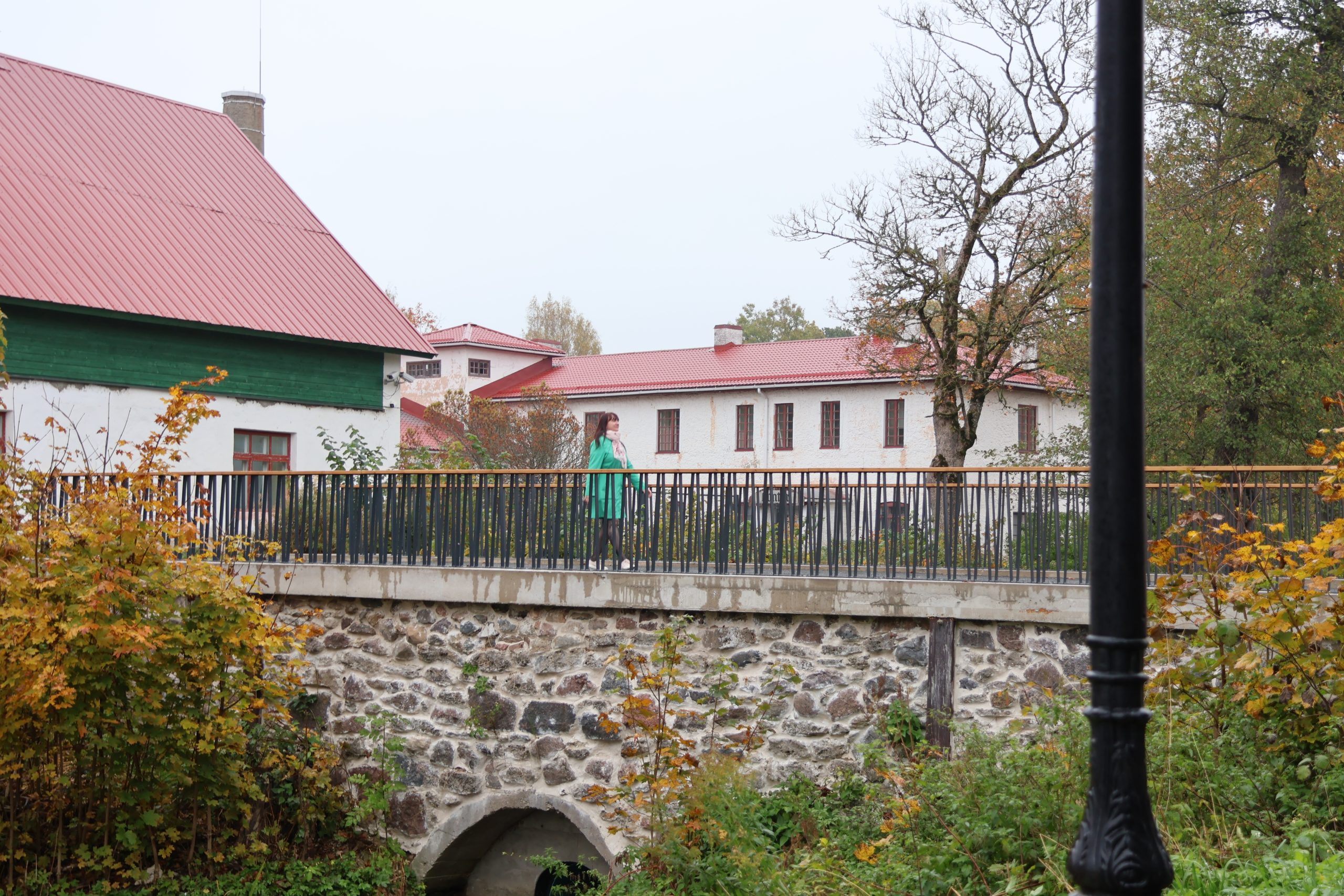
Moving further along Lossi Street, you will pass the former Paala Department Store – this is where the fabric for sewing the Estonian flag was purchased, the Põltsamaa Rural Municipality Government, and you will reach the Courthouse or Teacher’s Bridge (Kohtumaja ehk Õpetaja sild).
4. COURTHOUSE OR TEACHER’S BRIDGE (KOHTUMAJA EHK ÕPETAJA SILD)
As they say, a good child has many names. This beautiful bridge has gone through several name changes: Courthouse Bridge (Kohtumaja sild), Teacher’s Bridge (Õpetaja sild), Drunkard Bridge (Joodikute sild). From here, the priest went to work, the locals went to court, and the local Germans went to party. In 1944, the Germans put an end to the bridge, but a new pedestrian bridge was completed in 1957.
Once you have explored the Teacher’s Bridge (Õpetaja sild), we recommend continuing along Lossi Street. On your right are Kati cafe, where you can buy fresh pastries on the way, and with beautiful architectur Põltsamaa Church of the Holy Spirit. A little further along Lossi Street, you will reach the Sauna Bridge (Sauna sild).
5. SAUNA BRIDGE (SAUNA SILD)
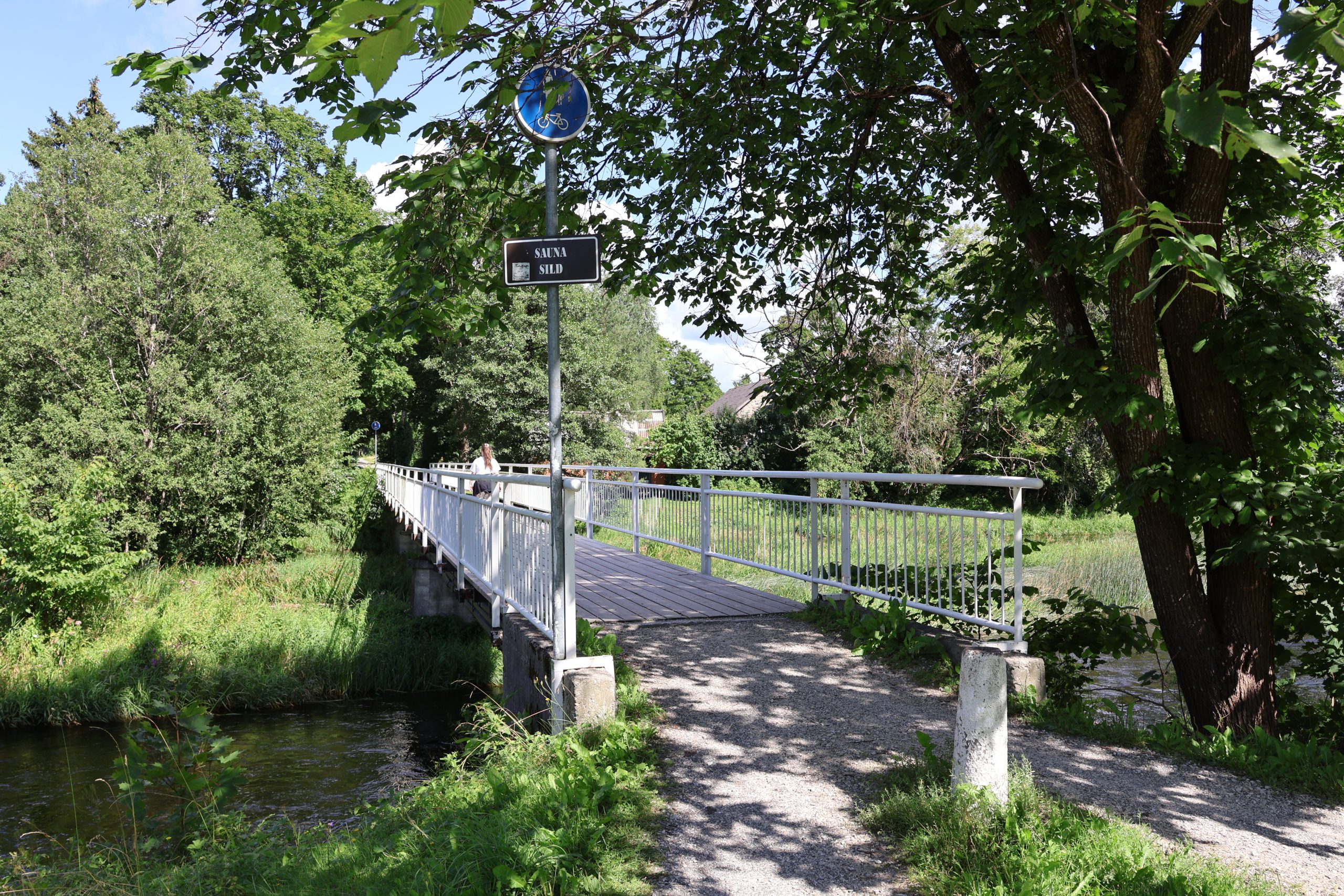
The bridge was named after the saunas that were heated on both banks. While on the bridge, take yourself back 100 years and imagine how the sauna built by Gutman in 1925 was heated, while at the same time a picturesque view of the rapids and rushing river appeared next to it – a real spa experience! The people have also called the bridge the Raam Bridge (Raami sild), because of Elmar Raam, the chairman of the Põltsamaa Town RSN Executive Committee, who helped rebuild the bridge.
When walking across the bridge, the small path to the left leads to the Kördiööbiku Park, which you can read more about on the large information board at the end of the path. At the end of this path is also the historic Põltsamaa Parish School building.
Continuing on, you will come to the Põltsamaa Cultural Center, where theater performances, concerts and other cultural events take place.
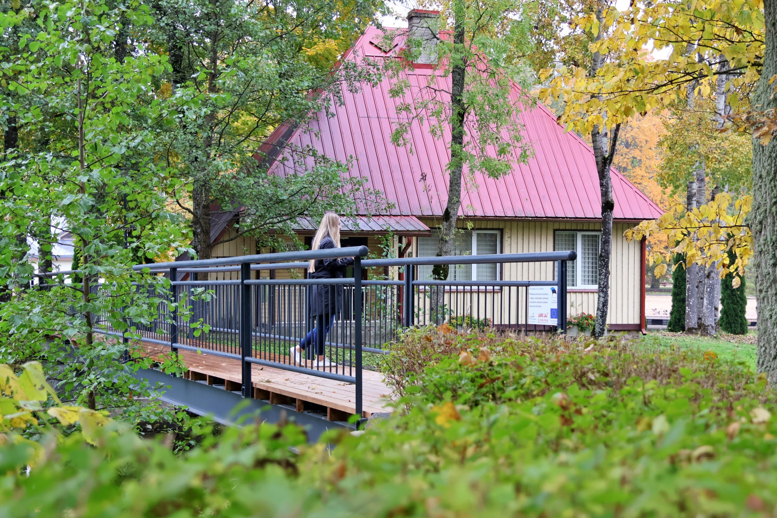
From behind the Culture House, through the park you will reach the Pardioja or Papioja Bridges (Pardioja ehk Papioja sild).
6. PARDIOJA OR PAPIOJA BRIDGES (PARDIOJA EHK PAPIOJA SILD)
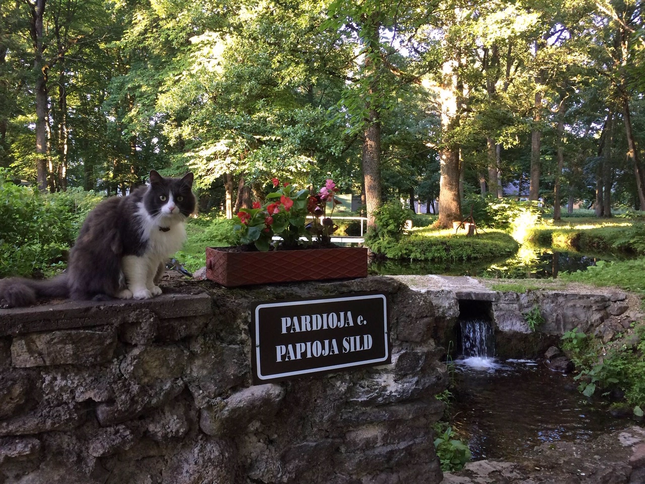
This name actually includes 5 small pedestrian bridges that lead over the Papioja stream in Rectory Park (Kirikla park). It is said that the name comes from the fact that the priests who lived in the rectory used to wash themselves in this stream. Crossing the bridges, you will eventually reach to the Rectory’s Islet (Kirklasaar) – this is where the rectory is located. Hidden behind the building, in the lap of nature, are three bridges from this set. There you will also be surprised by a mini-islet where you can enjoy peace.
Continuing along the main road from the rectory building, you will be at the Kose-Allika Bridge (Kose-Allika sild).
7. KOSE-ALLIKA BRIDGE (KOSE-ALLIKA SILD)
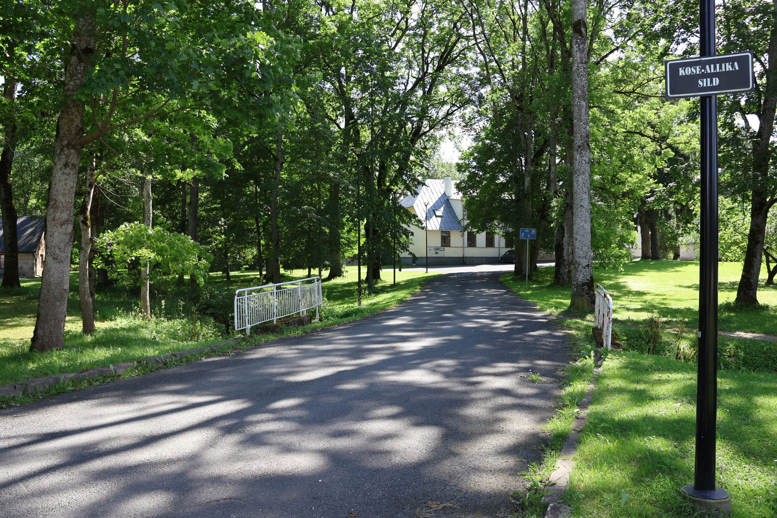
A small bridge that allows vehicles to reach rectory. Above the cultural center, there were once stone stables of rectory, which were demolished after the war. A plank fence surrounds the buildings of rectory. Other villagers could also keep their animals in the stables. The name of the bridge was inspired by the Kiisamauru waterfall and Allika Street.
To the left of the Kose-Allika Bridge (Kose-Allika sild) is the Kiisamauru Bridge (Kiisamauru sild) and the fragrant Rose Island (Roosisaar).
8. KIISAMAURU BRIDGE (KIISAMAURU SILD)
Marked on the map as early as 1688. A “Mauru” is a place in a river where the water foams and roars due to rocks or a dam. It is not clear whether the first half of the term refers to the Kiisa fish or a miller named Kiisa.
Cross the Kiisamuru Bridge (Kiisamauru sild), in the summertime wander through beautiful roses, and you will reach to the Small Bridge (Väike sild).
9. SMALL BRIDGE (VÄIKE SILD)
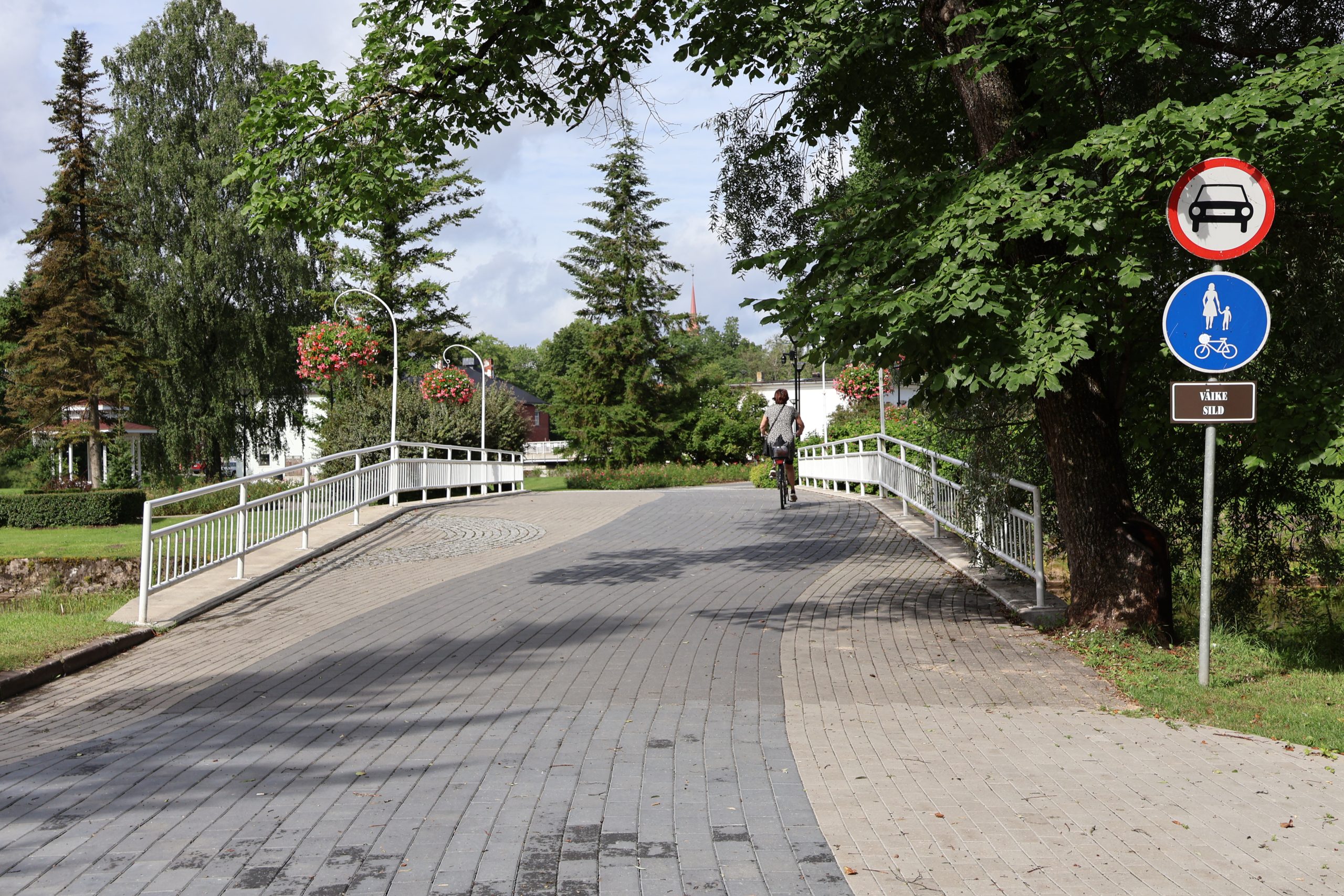
On the 1876 map of the Neu-Oberpahlen manor, the Small Bridge (Väike sild) is drawn as a wooden bridge, but it certainly existed many years earlier. The Small Bridge (Väike sild) is also known as the Curate’s Bridge (Köstri sild), because the curate’s residence was located on the bank of the Mill Canal (Veskikanal) near the bridge. In 1881, the bridge was replaced with a new stone bridge. Previously, traffic in Põltsamaa ran across the Big Bridge (Suur sild) to the islet and across the Mill Canal (Veskikanal) towards Jõgeva via the Small Bridge (Väike sild). The bridge was blown up during the war and restored during the Soviet era.
A memorial monument has been erected near the Small Bridge (Väike sild) to those who deported to Siberia.
The Small Bridge (Väike sild) takes you to the Rose Island (Roosisaar), which was transformed into an islet of the same name in 2021. 2000 rose bushes have been planted on the islet, an arbor has been built, and sidewalks have been laid. Before World War II, the islet was the center of the town, there were many companies located here, and the islet was called the Business Islet (Kaubasaar). You can read more about it and see pictures on the Rose Island (Roosisaar) information board.
Continuing uphill through the Rose Island, you will reach the Särtsu Bridge (Särtsu sild).
10. SÄRTSU BRIDGE (SÄRTSU SILD)
The youngest bridge in Põltsamaa – connects the former power plant to the Rose Island (Roosisaar). The Särtsu Bridge (Särtsu sild) got its name in 2019.
The Põltsamaa Hydroelectric Power Plant began operating here in 1929. The facility was damaged during World War II and was restored in 1950, but it still ceased operations in 1994. The power plant consisted of station buildings on both sides of the River Põltsamaa and a dam.
The Särtsu Bridge (Särtsu sild) is not to be missed by the Big Bridge (Suur sild) located next to it.
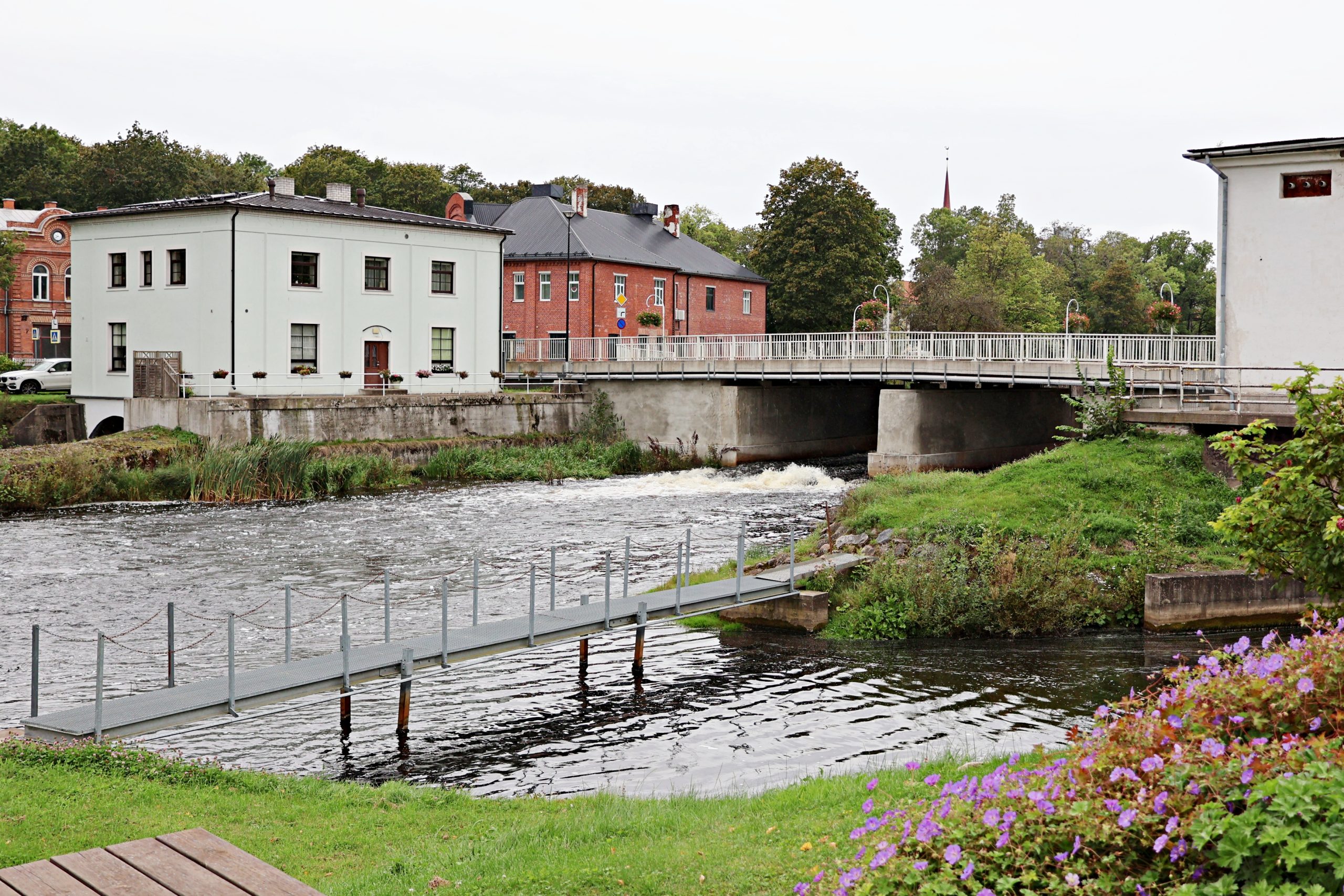
11. BIG BRIDGE (SUUR SILD)
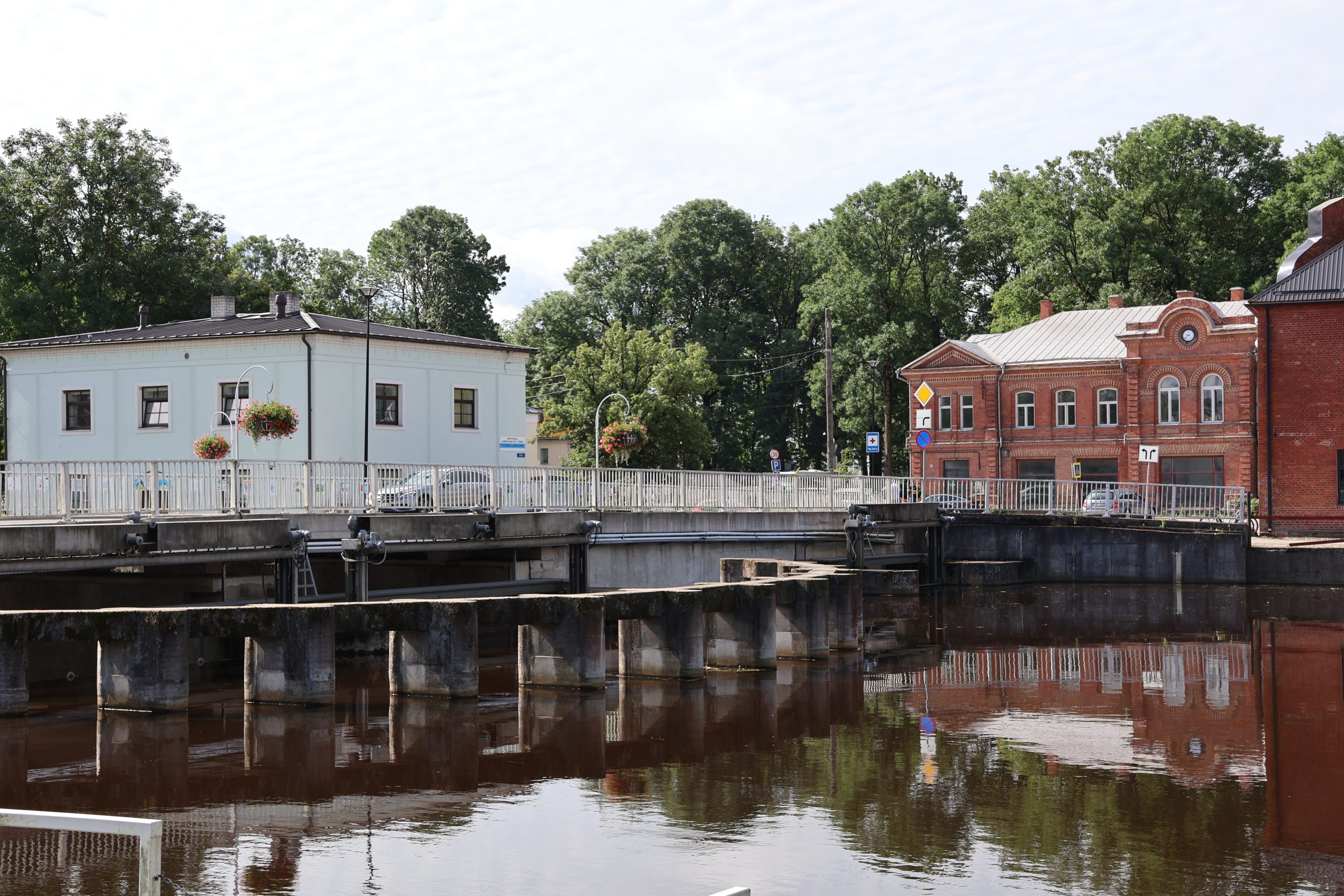
The Big Bridge (Suur sild) was already marked on a Swedish-era map from 1688. In 1856, the German artist Wilhelm Siegfried Stavenhagen (1814-1881) captured the wooden bridge on a steel engraving. Next to the old wooden bridge, construction of a new stone bridge began in 1872, with the general responsibility for which fell to the Pajusi manor house owner Nikolai von Wahl, as the head of the Põltsamaa church. The builder was Gustav Beermann (yes, the same man who erected the Kaarli church in Tallinn) and he was helped by peasants from the surrounding parishes. The new bridge was completed in 1874. The old wooden bridge captured on the engraving was demolished. One construction worker died and several others were injured during the demolition. And of course, this bridge also did not escape the bombing of 1944.
In 2013, the Big Bridge (Suur sild) dam was renovated and a modern fish pass was built – it has also been called the building of the century in Põltsamaa. In 2017, the Big Bridge was completely renovated.
While on the Big Bridge (Suur sild), you should definitely stop by the restaurant Postimaja Lokaal, located at the end of the bridge, where the post office once stood.
With your stomach full and your spirits up, it’s time to hit the road again. The next stop is the Ring Road Bridge (Ringtee sild), which you can reach by walking back across the Big Bridge (Suur sild) from the post office.
12. RING ROAD BRIDGE (RINGTEE SILD)
The Ring Road Bridge (Ringtee sild) was built in conjunction with the new traffic regulations in 1964-1965. In order to divert traffic slightly away from the town center, a ring road was built in 1965 near the river branch (directly viewed from the Big Bridge). However, before that, a bridge was built over the river branch in 1964 under the supervision of roadmaster Evald Kapp. It is currently called the Ring Road Bridge (Ringtee sild). In earlier times, the bridge was known in documents as the Canal Bridge (Kanali sild).
Right next to the Ring Road Bridge (Ringtee sild) is the Mill Bridge (Veski sild).
13. MILL BRIDGE (VESKI SILD)
The bridge that takes people across the Mill Canal (Veskikanal) was already marked on a Swedish-era map from 1688. The Mill Bridge (Veski sild) became a stone bridge a year after the completion of the Big Bridge (Suur sild).
When crossing the Mill Bridge (Veski sild), on the right you will find the café and guesthouse Rivaal, and right next to it is the library and the War of Independence monument. On the left you will find the newly completed shore path and the Põltsamaa beach area, where there are volleyball and basketball courts, a children’s playground and an outdoor gym. The beach cafe Põltsamaa Rannakohvik is open during the summer. The Põltsamaa Youth Centre is also located there.
Moving upstream, you will find the secondary school Põltsamaa Ühisgümnaasium and a little further on you will reach the Women’s Islet Bridge (Naistesaare sild).
14. WOMEN’S ISLET BRIDGE (NAISTESAARE SILD)
In the 1920s and 1930s, this bridge led to a place where there was a women’s beach and a bathhouse. Imagine the ladies walking across the bridge in their gorgeous swimsuits.
To the right across the road is New-Põltsamaa Manor, the main building of which has survived to this day.
A little further on, you will come across the Parvei or Church Hill Bridge (Parvei ehk Kirikumäe sild).
15. PARVEI OR CHURCH HILL BRIDGE (PARVEI EHK KIRIKUMÄE SILD)
Parvei or Church Hill Bridge (Parvei ehk Kirikumäe sild) is a suspension bridge installed in 2006 on the site of an ancient bridge. Until 1600, the first Põltsamaa church stood at this place on the left bank of the river, from which the bridge was named – Church Hill Bridge. From 1928 until the Second World War, August Parvei’s industries were located in this place. He built a large wool and flour industry on the left bank of the river from existing mills, and a sawmill on the right bank. The companies were called Parvei Industries and the bridge between them was called Parvei Bridge (Parvei sild). When the Germans left in 1944, the Parvei Bridge (Parvei sild) suffered the same fate as the others.
Cross the bridge and turn left – you are now reaching the newly built riverside path, which offers you a pleasant walk along the riverbank.
16. WINERY BRIDGE (VEINITEHASE SILD)
At the end of the shoreline, the Winery Bridge (Veinitehase sild) awaits, named after the winery that operated here at the beginning of the 20th century. The bridge leads to the Bleach Islet (Pleeksaar) or the Winery Islet (Veinitehase saar) – this is the islet closest to the castle. The house on the islet is currently used by the Jordanian congregation. Previously, there was a manor laundry here, where linen was probably bleached – hence the name the Bleach Islet (Pleeksaar). There was a blacksmith shop here, and a bridge also led to the left bank of the river. The building housed the manor’s brewery and the ETK winery.
Turn-of-the-century photos show that the Winery Bridge (Veinitehase sild) was an curved stone bridge.
Continue along the shoreline path towards the castle and you will reach the next bridge.
17. WATER GATE BRIDGE (VESIVÄRAVA SILD)
The Water Gate Bridge (Vesivärava sild), which crosses the moat, leads to the back of the castle. In 2014, the street next to the moat was named after this bridge – Vesivärava Street. This bridge was also already present in the 17th-century plan of the fortress.
Continue along the castle wall and soon the penultimate bridge will appear on the left.
18. SAARIKU BRIDGE (SAARIKU SILD)
The locals use the term “saarik” for a small islet located in the river, hence the name Saariku Bridge (Saariku sild). This bridge was also marked on the 17th-century plan of the fortress. You can often meet fishermen at Saariku Bridge (Saariku sild).
As you continue along the river, you will see the last of the Põltsamaa bridges.
19. HUNTERS BRIDGE (JAHIMEESTE SILD)
This bridge takes you to a small islet where the Põltsamaa Jahiseltsi hunting lodge is located – that is how the bridge got its name – Hunters Bridge (Jahimeeste sild).
This bridge is also present on the 17th century plan of the fortress, as well as on maps from 1857 and 1876. Legend has it that there was a sauna on the islet, where the Russian Empress Catherine II used to take a bath in the sauna and later in the river. The Sauna Islet (Saunasaar) was also called the “sakste saarik”.
With this, you have reached the end of the tour and have seen all 19 bridges and 5 islets of Põltsamaa: the Rose Island (Roosisaar), the Rectory’s Islet (Kiriklasaar), the Bleach Islet (Pleeksaar), the Women’s Islet (Naistesaar) and the Sauna Islet (Saunasaar).
To learn more about the bridges and the historical heritage surrounding them, book a guided bridge tour at Põltsamaa Castle.
See more opportunities in Põltsamaa here: visitpoltsamaa.com